The United Kingdom lies near North Atlantic sea lanes; only 35 km from France and linked by tunnel under the English Channel. The United Kingdom is situated off the northwest coast of Europe between the Atlantic Ocean on the N and NW and the North Sea on the E, separated from the Continent by the Strait of Dover and the English Channel and from the Irish Republic by the Irish Sea and St. George’s Channel. The United Kingdom is one of the most highly industrialized countries in the world. The capital, London is the major financial centre of the world.
:: Geography of United Kingdom ::
Location: Western Europe, islands including the northern one-sixth of the island of Ireland between the North Atlantic Ocean and the North Sea, northwest of France.
Geographic coordinates: 54 00 N, 2 00 W
Area:
total: 244,820 sq km
land: 241,590 sq km
water: 3,230 sq km
note: includes Rockall and Shetland Islands
Area – comparative: slightly smaller than Oregon.
Land boundaries: total: 360 km, border countries: Ireland 360 km
Maritime claims:
territorial sea: 12 nm
exclusive fishing zone: 200 nm
continental shelf: as defined in continental shelf orders or in accordance with agreed upon boundaries
Climate: temperate; moderated by prevailing southwest winds over the North Atlantic Current; more than one-half of the days are overcast.
Terrain: mostly rugged hills and low mountains; level to rolling plains in east and southeast.
Elevation extremes: lowest point: The Fens -4 m; highest point: Ben Nevis 1,343 m
Natural resources: coal, petroleum, natural gas, iron ore, lead, zinc, gold, tin, limestone, salt, chalk, gypsum, potash, silica sand, slate, arable land.
Land use:
arable land: 23.23%
permanent crops: 0.2%
other: 76.57% (2005)
Natural hazards: winter windstorms; floods.
Environment – current issues: continues to reduce greenhouse gas emissions (has met Kyoto Protocol target of a 12.5% reduction from 1990 levels and intends to meet the legally binding target and move toward a domestic goal of a 20% cut in emissions by 2010); by 2005 the government reduced the amount of industrial and commercial waste disposed of in landfill sites to 85% of 1998 levels and recycled or composted at least 25% of household waste, increasing to 33% by 2015.
Environment – international agreements: party to: Air Pollution, Air Pollution-Nitrogen Oxides, Air Pollution-Persistent Organic Pollutants, Air Pollution-Sulfur 94, Air Pollution-Volatile Organic Compounds, Antarctic-Environmental Protocol, Antarctic-Marine Living Resources, Antarctic Seals, Antarctic Treaty, Biodiversity, Climate Change, Climate Change-Kyoto Protocol, Desertification, Endangered Species, Environmental Modification, Hazardous Wastes, Law of the Sea, Marine Dumping, Marine Life Conservation, Ozone Layer Protection, Ship Pollution, Tropical Timber 83, Tropical Timber 94, Wetlands, Whaling. signed, but not ratified: none of the selected agreements.
In this Country Profile
:: People of United Kingdom ::
Population: 60,943,912 (July 2008 est.)
Age structure:
0-14 years: 16.9% (male 5,287,590/female 5,036,881)
15-64 years: 67.1% (male 20,698,645/female 20,185,040)
65 years and over: 16% (male 4,186,561/female 5,549,195) (2008 est.
Median age:
total: 39.9 years
male: 38.8 years
female: 41 years (2008 est.)
Population growth rate: 0.276% (2008 est.)
Birth rate: 10.65 births/1,000 population (2008 est.)
Death rate: 10.05 deaths/1,000 population (2008 est.)
Net migration rate : 2.17 migrant(s)/1,000 population (2008 est.)
Sex ratio:
at birth: 1.05 male(s)/female
under 15 years: 1.05 male(s)/female
15-64 years: 1.02 male(s)/female
65 years and over: 0.75 male(s)/female
total population: 0.98 male(s)/female (2008 est.)
Infant mortality rate:
total: 4.93 deaths/1,000 live births
male: 5.49 deaths/1,000 live births
female: 4.34 deaths/1,000 live births (2008 est.)
Life expectancy at birth:
total population: 78.85 years
male: 76.37 years
female: 81.46 years (2008 est.)
Total fertility rate: 1.66 children born/woman (2008 est.)
HIV/AIDS – adult prévalence rate: 0.2% (2001 est.)
HIV/AIDS – people living with HIV/AIDS: 51,000 (2001 est.)
HIV/AIDS – deaths: fewer than 500 (2003 est.)
Nationality: noun: Briton(s), British (collective plural) adjective: British
Ethnic groups: white (of which English 83.6%, Scottish 8.6%, Welsh 4.9%, Northern Irish 2.9%) 92.1%, black 2%, Indian 1.8%, Pakistani 1.3%, mixed 1.2%, other 1.6% (2001 census)
Religions: Christian (Anglican, Roman Catholic, Presbyterian, Methodist) 71.6%, Muslim 2.7%, Hindu 1%, other 1.6%, unspecified or none 23.1% (2001 census)
Languages: English, Welsh (about 26% of the population of Wales), Scottish form of Gaelic (about 60,000 in Scotland)
Literacy:
definition: age 15 and over has completed five or more years of schooling.
total population: 99%
male: 99%
female: 99% (2003 est.)
Geography of United Kingdom: Important Geographical Information about United Kingdom
In this Country Profile
The vaporous magnificence of the Wales Waterfalls, the vast mirror lakes of Northern Ireland, millions of hectares sublime landscapes…it is the fascinating and diverse Britain! One of the unique aspects of the stunning landscape of the United Kingdom is its enormous variation, ranging from the Grampian Mountains of Scotland to the lowland fens of England which are at or below sea level in several places. Scotland and Wales are the most mountainous parts of the UK.
Geography of the United Kingdom
Most of England’s breathtaking scenery consists of rolling hills, but it is more mountainous in the north with a chain of low mountains, the Pennines. England has a temperate climate, with plentiful rainfall all year round. It is closer to Continental Europe than any other part of Britain, divided from France only by a 21-mile (34-km) sea gap. The Severn is the longest English river which rises in central Wales and flows through Shrewsbury, Worcester and Gloucester in England to the Bristol Channel. London, Cambridge, Liverpool are among England’s major towns.
Northern Ireland is absolutely marvelous. The shorelines are characterized by many irregularities. It is also home to the UK’s largest lake, Lough Neagh, which covers an area of 396sq.km and is surrounded by mountains. The highest point in the country is Slieve Donard, a peak in the Mourne Mountains, it is 2796 feet/852 meters tall.
The beauty of the landscape seems untouched. Scotland is the northern portion of Great Britain. The deepest lake is Loch Morar in the Highlands 1,017 ft (310 m) deep and the highest mountain is Ben Nevis 4,406 ft (1,343 m).Between the Highlands and the Lowlands there is a well-marked division, the valley known as Strathmore.
Scotland has a wide lowland area between the Grampians and the Southern Uplands where most of the population is located. Wales’s landscape is mountainous, particularly in Snowdonia and the central Cambrian Mountains, mountains that were shaped during the last ice age. Deepest cave is Ogof Ffynnon Ddu, Powys, 1,010 ft (308 m) deep and the highest mountains in Wales are in Snowdonia, and include Snowdon which, at 1,085 m (3,560 ft) is the highest peak in Wales.
There is also a traditional list of seven geographic and cultural landmarks in Wales and these are: Snowdon (the highest mountain), the Gresford bells (the peal of bells in the medieval church of All Saints at Gresford), the Llangollen bridge (built in 1347 over the River Dee), St Winefride’s Well (a pilgrimage site at Holywell in Flintshire) the Wrexham steeple (16th century tower of St. Giles Church in Wrexham), the Overton yew trees (ancient yew trees in the churchyard of St Mary’s at Overton-on-Dee) and Pistyll Rhaeadr (Wales’s tallest waterfall, at 240 ft or 75 m).
Professional Translation Organizations & Associations in United Kingdom
In this Country Profile
Below is a list of the major translation organizations and associations of United Kingdom. Day Translations seeks to be involved with translation organizations to improve the knowledge and awareness of the importance of translation and interpretation in our constantly changing, global world.
:: List of Organizations ::
Association of Police & Court Interpreters
Association of Translation Companies
Aston University (Aston in Birmingham)
Birkbeck College (Univ. of London)
Cambridge University (ESOL Examinations, External, Misc.)
Cambridge University (Lang. Degrees)
Chartered Institute of Linguists
City University (London)
Graduate School of Arts & Humanities, University of Glasgow
Heriot Watt University (Edinburgh)
Imperial College London
Imperial College London (Univ. of London)
Institute of Linguists Educational Trust, City University
Institute of Translation & Interpreting
London Metropolitan University
Napier University
National Register of Public Service Interpreters – UK
Roehampton University, School of Arts
School of Languages, Linguistics and Film at Queen Mary, University of London
SOAS (School of Oriental and African Languages – Univ. of London)
Society of Authors: Translators Assoc.
The Open University
The Translators’ Association
The University of Nottingham
UMIST (The University of Manchester Institute of Science & Technology)
University College London (London Univ.)
University of Bath
University of Birmingham
University of Bradford
University of Bristol
University of East Anglia
University of Edinburgh
University of Essex
University of Hull
University of Kent at Canterbury
University of Leeds
University of Luton
University of Manchester
University of Middlesex
University of Newcastle-upon-Tyne
University of North London, School of European and Languages Studies
University of Portsmouth
University of Salford
University of Sheffield
University of Surrey
University of the West of England (Bristol)
University of Wales, Swansea (Prifysgol Cymru Abertawe)
University of Warwick
University of Westminster
Information about the British Flag: Colors and Meaning of the Flag of United Kingdom
In this Country Profile
:: Meaning of the United Kingdom Flag ::
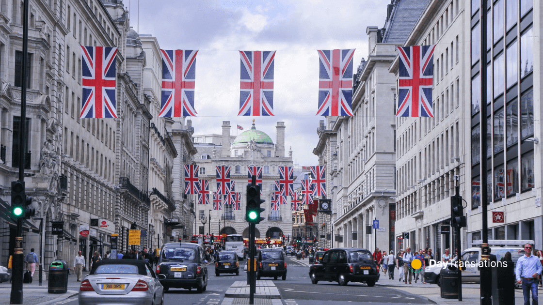
The United Kingdom is a unitary state consisting of four countries: England, Scotland, Northern Ireland and Wales. It is called the Union Flag because it symbolizes the administrative union of the countries of the United Kingdom. The shape and flag ratio of the United Kingdom Flag is described as 1:2 (length twice the height). The current Union Flag dates from 1 January 1801 with the Act of Union 1800, which merged the Kingdom of Ireland and the Kingdom of Great Britain making it one of the oldest flags in the world.
The individual flags of England, Scotland and of Northern Ireland united under one Sovereign represent the Union Flag. As Wales was not a Kingdom but a Principality it could not be included on the flag. As the picture above shows, the colors of the British flag are: red, blue and white. The pattern of the flag consists of the red cross of Saint George (patron saint of England) edged in white, superimposed on the Cross of St Patrick (patron saint of Ireland), which are superimposed on the Saltire of Saint Andrew (patron saint of Scotland). The British flag seems to be a symbol of Christianity.
:: Meaning of the British Coat of Arms ::
The Royal Coat of Arms of the United Kingdom is used by the Queen in her official capacity as monarch, and is officially known as her Arms of Dominion. The coat features both the motto of British Monarchs: “Dieu et Mon Droit”, “God and My Right.” and the motto of the Order of the Garter: “Hon Y Soit Qui Mal Y Pense”, “Shame to him who evil thinks.” The arms have remained unchanged since Queen Victoria. The shield reflects the British history and shows the various royal emblems of different parts of the United Kingdom: three gold lions with their right forepaws raised and their heads facing the viewer in the first and fourth quarters, the lion of Scotland in the second and the harp of Ireland in the third. The shield is supported by the English lion on the left and Scottish unicorn on the right.
Extensive List of Languages of United Kingdom: Spoken and Extinct Languages
In this Country Profile
United Kingdom of Great Britain and Northern Ireland. 60,270,708. National or official languages: English, Welsh, French (regional). Literacy rate: 97% to 99%. Also includes Assyrian Neo-Aramaic (5,000), Bengali (400,000), Eastern Panjabi (471,000), Estonian (14,000), Greek (200,000), Gujarati (140,000), Hakka Chinese (10,000), Hebrew (8,000), Hindi (243), Italian (200,000), Japanese (12,000), Judeo-Iraqi Arabic, Kashmiri (115,000), Kirmanjki, Latvian (12,000), Leeward Caribbean Creole English, Lithuanian, Malayalam (21,000), Maltese (40,900), Mandarin Chinese (12,000), Mirpur Panjabi (20,000), Moroccan Spoken Arabic (5,800), Northern Kurdish (23,766), Northern Pashto, Parsi (75,000), Portuguese (17,000), Seraiki, Shelta (30,000), Sindhi (25,000), Somali (1,600), Southern Pashto (87,000), Southwestern Caribbean Creole English (170,000), Sylheti (300,000), Tagalog (74,000), Ta’izzi-Adeni Spoken Arabic (29,000), Tamil, Turkish (60,000), Urdu (400,000), Vietnamese (22,000), Western Farsi (12,000), Western Panjabi (102,500), Yoruba (12,000), Yue Chinese (300,000), people from Ghana, Nigeria, Guyana, West Indies. Information mainly from I. Hancock 1974, 1984, 1986; M. Stephens 1976; R. McCrum, W. Cran, R. MacNeil 1986; B. Comrie 1987. Blind population: 116,414. Deaf population: 909,000 to 3,524,725 (1998). Deaf institutions: 468 in England, 2 in Northern Ireland, 14 in Scotland, 34 in Wales. The number of languages listed for United Kingdom is 18. Of those, 12 are living languages, 2 are second language without mother-tongue speakers, and 4 are extinct.
:: List of Languages ::
Angloromani [rme] 90,000 in Britain (1990 I. Hancock). Population total all countries: 195,000. England, Wales, Scotland. Also spoken in Australia, South Africa, USA. Alternate names: English Romani, Romani English, Romanichal, Pogadi Chib, Posh ‘N’ Posh. Dialects: Angloromani not inherently intelligible with Welsh Romani, Traveller Swedish, Traveller Norwegian, or Traveller Danish. The grammar is basically English with heavy Romani lexical borrowing. Many dialects. Classification: Mixed Language, English-Romani.
British Sign Language [bfi] 40,000 first-language users (1984 Deuchar), out of 909,000 deaf, of which the majority probably have some degree of sign language competence (1977 Deuchar). United Kingdom including Northern Ireland, Scotland. Alternate names: BSL. Dialects: Not inherently intelligible to users of American Sign Language. The deaf community is cohesive, so communication is good despite regional differences. Classification: Deaf sign language.
Cornish [cor] A number of people under 20 years of age are first-language speakers. There are 500 speakers who use Cornish, and about 100 others who speak it fluently (2003). Ethnic population: 468,425 (1991 census). Duchy of Cornwall, southwest England. A few in Canada and Australia. Alternate names: Kernowek, Kernewek, Curnoack. Dialects: Related to Breton, Welsh, Gaulish (extinct), Irish Gaelic, Manx Gaelic, Scots Gaelic. Classification: Indo-European, Celtic, Insular, Brythonic.
English [eng] 55,000,000 in United Kingdom (1984). 508,000,000 including second-language speakers (1999 WA). Population total all countries: 309,352,280. Also spoken in American Samoa, Andorra, Anguilla, Antigua and Barbuda, Aruba, Australia, Bahamas, Barbados, Belize, Bermuda, Botswana, British Indian Ocean Territory, British Virgin Islands, Brunei, Cambodia, Cameroon, Canada, Cayman Islands, China, Cook Islands, Denmark, Dominica, Dominican Republic, Ecuador, Eritrea, Ethiopia, Falkland Islands, Fiji, Finland, Gambia, Germany, Ghana, Gibraltar, Greece, Grenada, Guadeloupe, Guam, Guyana, Honduras, India, Ireland, Israel, Italy, Jamaica, Japan, Kenya, Kiribati, South Korea, Lebanon, Lesotho, Liberia, Malawi, Malaysia (Peninsular), Malta, Marshall Islands, Mauritius, Mexico, Micronesia, Montserrat, Namibia, Nauru, Netherlands Antilles, New Zealand, Nigeria, Niue, Norfolk Island, Northern Mariana Islands, Norway, Pakistan, Palau, Papua New Guinea, Philippines, Pitcairn, Puerto Rico, Rwanda, Saint Helena, Saint Kitts and Nevis, Saint Lucia, Saint Pierre and Miquelon, Saint Vincent and the Grenadines, Samoa, Saudi Arabia, Seychelles, Sierra Leone, Singapore, Solomon Islands, Somalia, South Africa, Sri Lanka, Suriname, Swaziland, Switzerland, Tanzania, Tokelau, Tonga, Trinidad and Tobago, Turks and Caicos Islands, U.S. Virgin Islands, Uganda, United Arab Emirates, USA, Vanuatu, Venezuela, Zambia, Zimbabwe. Dialects: Cockney, Scouse, Geordie, West Country, East Anglia, Birmingham (Brummy, Brummie), South Wales, Edinburgh, Belfast, Cornwall, Cumberland, Central Cumberland, Devonshire, East Devonshire, Dorset, Durham, Bolton Lancashire, North Lancashire, Radcliffe Lancashire, Northumberland, Norfolk, Newcastle Northumberland, Tyneside Northumberland, Lowland Scottish, Somerset, Sussex, Westmorland, North Wiltshire, Craven Yorkshire, North Yorkshire, Sheffield Yorkshire, West Yorkshire. Lexical similarity 60% with German, 27% with French, 24% with Russian. Classification: Indo-European, Germanic, West, English.
French [fra] 14,000 in England (1976 Stephens). Channel Islands. Dialects: Jerriais, Dgernesiais. Classification: Indo-European, Italic, Romance, Italo-Western, Western, Gallo-Iberian, Gallo-Romance, Gallo-Rhaetian, Oïl, French.
Gaelic, Irish [gle] 95,000 in United Kingdom (2004). Belfast and counties of Fermanagh and Armagh, Northern Ireland. Alternate names: Irish, Erse, Gaeilge. Classification: Indo-European, Celtic, Insular, Goidelic.
Gaelic, Scottish [gla] 58,650 in United Kingdom (2003 census). Population total all countries: 62,175. North and central counties of Ross, islands of Hebrides and Skye, Glasgow. Also spoken in Australia, Canada, USA. Alternate names: Gàidhlig, Gaelic, Scots Gaelic, Albannach Gaidhlig, Erse. Dialects: East Sutherlandshire. Church Gaelic is based on the Perthshire dialect of 200 years ago, and is at a distance from spoken dialects. East Sutherlandshire dialect is so different from other spoken dialects as to be a barrier to communication. Classification: Indo-European, Celtic, Insular, Goidelic.
Polari [pld] Alternate names: Parlare, Parlary, Palarie, Palari, Parlyaree. Classification: Unclassified.
Romani, Vlax [rmy] 4,100 in United Kingdom (2004). Alternate names: Romenes, Rom, Tsigane. Dialects: Kalderash, Lovari. Classification: Indo-European, Indo-Iranian, Indo-Aryan, Central zone, Romani, Vlax.
Romani, Welsh [rmw] England and Wales. Dialects: Not inherently intelligible with Angloromani. Classification: Indo-European, Indo-Iranian, Indo-Aryan, Central zone, Romani, Northern.
Scots [sco] 100,000 in United Kingdom (1999 Billy Kay). Some population estimates are much higher. Population total all countries: 200,000. All of Scotland except highlands: lowlands: Aberdeen to Ayrshire. Northern Ireland. Also spoken in Ireland. Dialects: Insular, Northern Scots, Southern Scots, Ulster. Difficult intelligibility among dialects. Northern Scots on the Scottish Islands is considered by some to be a different language (Shetlandic or Orcadian). Lallans is the main literary dialect. Ulster Scots has its own development group. Scots is closest to English and Frisian. Classification: Indo-European, Germanic, West, English.
Traveller Scottish [trl] 4,000 in Scotland. Also spoken in Australia, USA. Alternate names: Scottish Cant, Scottish Traveller Cant. Classification: Unclassified.
Welsh [cym] 508,098 in United Kingdom (1991 census). Out of 575,102 speakers in 1971, it included 32,700 monolinguals, 542,402 bilinguals (1971 census). Population total all countries: 536,258. Northern, western, and southern Wales. Also spoken in Argentina, Canada. Alternate names: Cymraeg. Dialects: Northern Welsh, Southern Welsh, Patagonian Welsh. Classification: Indo-European, Celtic, Insular, Brythonic.
Yinglish [yib] Classification: Indo-European, Germanic, West, English.
:: List of Extinct Languages ::
Gaelic, Hiberno-Scottish [ghc] Extinct. Ireland and Scotland. Alternate names: Gaoidhealg, Hiberno-Scottish Classical Common Gaelic. Classification: Indo-European, Celtic, Insular, Goidelic.
Manx [glv] Extinct. Ethnic population: On the Isle of Man: 77,000 residents (1998 UN). Isle of Man, part of the British Isles, a Crown Dependency, with its own Parliament, laws, currency, and taxation. The United Kingdom represents the Isle of Man at the United Nations. Alternate names: Gaelg, Gailck, Manx Gaelic. Dialects: Close to Scottish Gaelic. Classification: Indo-European, Celtic, Insular, Goidelic.
Norn [nrn] Extinct. Shetland and Orkney Islands. Classification: Indo-European, Germanic, North, West Scandinavian.
Old Kentish Sign Language [okl] Extinct. Kent. Classification: Deaf sign language.
:: Reference ::
Gordon, Raymond G., Jr. (ed.), 2005. Ethnologue: Languages of the World, Fifteenth edition. Dallas, Tex.: SIL International. Online version: http://www.ethnologue.com/
Famous British People: Canadian Artists, Scientists, Leaders, Musicians, Politicians and Athletes
In this Country Profile
The United Kingdom produced throughout the years a large number of notable people worthy of attention. Thinkers, explorers, kings and queens, writers, musicians, scientists and many other are well known around the world as the celebrities of U.K. or as famous Britons. They have one thing in common: are not easy to stereotype.
The following people made their mark on both the local and international scenes. They are just some of many famous Britons who have lifted United Kingdom’s name worldwide and made a difference in our world. Their purpose and stories inspired awe if not greatness.
:: List of Famous People from United Kingdom ::
William Shakespeare
“It is not only the crowning glory of England but also the crowning glory of all mankind that such a man as William Shakespeare should ever have been born”.
William Shakespeare quotes such as “To be, or not to be”, “This above all: to thine own self be true”, “O Romeo, Romeo! wherefore art thou Romeo?”, “I’ll not budge an inch”, “We have seen better days” represent some of literature’s most famous and celebrated lines, people are fascinated by the words of Shakespeare and they have become catch phrases in the daily speech. „The Bard of Avon” is widely regarded by many to have been the greatest writer the English language has ever known, the world’s preeminent dramatist, not merely for his the lyrical grandeur, extraordinary genius and gift for language, but because “he was also the world’s greatest psychologist, with an uncanny ability to see and describe people’s most subtle emotional states,” as George Weinberg states.
His works consist of more than 35 plays, 154 sonnets, two long narrative poems and several other poems (more than 400). The exact figures are not known. Some of Shakespeare’s plays, such as Hamlet, Romeo and Juliet, Macbeth and King Lear are among the most famous literary works of the world. William Shakespeare has enduring fame, not only because he wrote extraordinary plays, but because he dared to be different and his everlasting works have the virtue of being fresh. Hence there is no emotion or activity or situation in the human condition that is not found in his plays.
Why should Shakespeare’s timeless work be regarded as the topmost achievement of man, the fulfillment of long centuries of human civilization and culture? Because…
– The Bard employed 9,360,433 words in his writings, out of which 27,780 are different words. An average individual uses less than 1,000 words in writing, a little more than that in speech and has a recognition vocabulary of about 5,000 words. Some of the greatest writers may have twice this capability.
– Today, English has a total vocabulary of two million words followed by German with 1,860,000 words, Russian with 1,360,000 words, and French with 1,260,000 words. Thus Shakespeare in the 16th Century used five times the number of words in modern German!
– Shakespeare is the most quoted writer in history. His plays have been translated into 50 languages. In the Oxford Dictionary of Quotations containing about 20,000 quotations, Shakespeare alone monopolizes a staggering 60 pages (10 per cent). He coined 1700 new words.
– More people visit the place of Shakespeare’s birth than that of any other human being. More books and articles have been written about him and his works than about any other individual or even any other single subject (at least till the age of computers!). Entire libraries and major sections of many famous libraries whether in Washington D.C or London are devoted to him”.
(Source: http://kinkazzoburning.blogspot.com/2006/11/polling-genius-shakespeare-dante-and.html)
Sir Winston Churchill
Was a British politician known chiefly for his leadership of the United Kingdom during World War II, politician, radical, noted statesman and orator, soldier, artist, and the twentieth century’s most famous and celebrated PM. Churchill became First Lord of the Admiralty in 1911, moreover he helped modernize the navy. Churchill was one of the first people to grasp the military potential of aircraft and in 1912 he set up the Royal Naval Air Service. He served as Prime Minister of the United Kingdom from 1940 to 1945 and from 1951 to 1955. He was renowned as a great character and a great leader, but as he was possessed of astonishing vision, he also made fatal mistakes that brought only failure.
Churchill won in 1953 the Literature Nobel Prize for his numerous published works, especially for his six-edition set The Second World War. In the 2002 BBC poll of the “100 Greatest Britons”, that was mentioned also in the introduction, he was proclaimed “The Greatest of Them All”. Even Time Magazine rated Churchill as one of the most influential leaders in history.
Isambard Kingdom Brunel
One of the most ingenious and prolific figures in engineering history ISAMBARD KINGDOM BRUNEL (1806-1859) built twenty-five railways lines, he engineered over 1,200 miles of railway, including lines in Ireland, Italy and Bengal, he built over a hundred bridges, five suspension bridges, eight pier and dock systems, three ships and a pre-fabricated army field hospital, he assisted in the building of the first tunnel under a navigable river.
The designs of the great British engineers of the 19th century revolutionized public transport and modern day engineering. “The commercial world thought him extravagant; but although he was so, great things are not done by those who sit down and count the cost of every thought and act.”
Of all of Brunel’s railway bridges, his last, and greatest, was to be the Royal Albert bridges, crossing the river Tamar at Saltash near Plymouth. Other works are: The Thames Tunnel, the Windsor Railway Bridge, which was built in 1861 – 1865, Hungerford Bridge, a suspension footbridge across the River Thames, the Clifton Suspension Bridge in Bristol spanning over 213 m, and 61 m above the River Avon and many others.
Diana, Princess of Wales
“Anywhere I see suffering that is where I want to be, doing what I can. I think the biggest disease the world suffers from in this day and age is the disease of people feeling unloved. I know that I can give love for a minute, for half an hour, for a day, for a month, but I can give. I am very happy to do that, I want to do that.”
Diana, Princess of Wales, is one of the most loved women in the world. She was the first wife of Charles, Prince of Wales. Their sons, Princes William and Henry, are second and third in line to the thrones of the United Kingdom and fifteen other Commonwealth Realms.
Lady Di was famous for using her position and power to help the ones in need. “People’s Princess” touched the lives of the sick, the homeless and everyday people with her warmth and humanity. She worked tirelessly for charity and spent even her last days working on behalf of AIDS victims being a leader supporter of the Red Cross. Dubbed the “Queen of Hearts” by then Prime Minister of England, John Major, Diana, of one of the most fabled women of the century, “revived a staid monarchy with her vitality, charm, and glamour and ushered in a new age for the British monarchy”.
Diana’s compassion, grace, and kindness, altruism still live on among us and her story continues to touch and inspire people from all walks of life. She reached more people and touched more lives in her short life than any of us could imagine.
Charles Darwin
Darwin, the eminent British naturalist, geologist, biologist, and author is the first of the evolutionary biologists, the originator of the concept of natural selection. He demonstrated that all species of life have evolved over time from common ancestors through the process called natural selection and he became famous for these theories of evolution and natural selection. “Darwin’s scientific discovery remains the foundation of biology, as it provides a unifying logical explanation for the diversity of life.”
His monumental works, The Origin of Species by Means of Natural Selection (1859) and The Descent of Man (1871) marked a new epoch, are works that changed the world. His works were violently attacked, had a tremendous impact on religious thought, and energetically defended. Darwin’s idea of evolution conflicted with many religious convictions and caused a firestorm of controversy.
Darwin ranks as one of the most influential scientific thinkers of all time!
John Lennon
One of the most well-known entertainment industry figures of the 20th century is the rock musician, singer, writer, songwriter, artist, actor and peace activist John Lennon. He gained worldwide fame as one of the founding members of The Beatles. Lennon was considered the leader of the Beatles, due to his superior age and also his astonishing musical abilities. There is no question that one of the world’s most beloved figures in music was John Lennon and the music he composed so mythic, so laced with legend. He is particularly famous across the globe for his messages of peace and love. John Lennon was a figurehead for the anti war Movement. Lennon used his popularity for fund raisers, voter-registration drives, and anti-war rallies and concerts.
John Lennon was shot dead in 1980 by an obsessed fan. His death shocked the world. Lennon remains an everlasting idol being considered by many to be amongst the world’s most prolific musicians.
David Beckham
Many of the world’s famous sports began in Britain, including cricket, football, lawn tennis, golf and rugby. David Beckham is a leading English footballer and a former star of the legendary team Manchester United. He is famous for the quality of his passing and his crosses, and he has scored many goals direct from special free kicks. He has twice been runner-up for FIFA World Player of the Year and in 2004 he was the world’s highest-paid footballer.
The David Beckham Academy in London was opened in 2005 and it is the largest sporting facility of its kind in Europe. “The mission of the David Beckham Academy is to provide excellence in pursuit of development.”
The football superstar is an elite advertising brand and a top style icon. David Beckham’s collaboration with the legendary Armani for the Emporio Armani Underwear Ad Campaign was told to worth over $46 million. Beckham is an icon of modern masculinity who inspired with his athletic prowess and devilish good looks the most famous designers like Dolce&Gabbana and even regular people worldwide.
Sir Isaac Newton
The British physicist, mathematician, astronomer, natural philosopher, alchemist, theologian is acclaimed as one of the foremost scientific intellects of all time, one of the most influential men in human history.
One of the most influential books in the history of science is Philosophiæ Naturalis Principia Mathematica, published in 1687. Newton described universal gravitation and the three laws of motion. His great works on optics and gravitation laid the groundwork for classical mechanics and served also as basis for modern engineering.
Naomi Campbell
The 1980s and 1990s were known as the supermodel era, because so many supermodels became famous in this period. Among them, Naomi Campbell, a supermodel, singer, actress, and fashion designer, was the first black cover girl for Vogue Paris and first black model to appear on the cover of Vogue UK and Nippon. She did numerous fashion and beauty campaigns for big brands like Versace, Yves Saint Laurent, Burberry, Guess, H&M, Louis Vuitton, Ralph Lauren, Valentino and Victoria’s Secret.
Naomi has been a prominent fashion model on the catwalk since the late 1980s; she is one of the world’s most in-demand and highly paid models. Her wealth from modeling is estimated to US$28 million. In the year 1991, Campbell was selected by People magazine as one of the 50 Most Beautiful People in the world.
Sir Alexander Graham Bell
A pioneer in the field of telecommunication, Sir Alexander Graham Bell, born in Edinburgh, Scotland was an eminent British scientist, inventor and innovator who is widely credited with the invention of the telephone. In 1877, he formed the Bell Telephone Company. Since his death in 1922, the telecommunication industry has undergone an amazing revolution. His invention changed the way people communicate.
Bell produced many other inventions, among these a vacuum jacket, an electric probe, and a hydrofoil which traveled above the water. It was the fastest boat at that time.
Sir Alexander Fleming
Sir Alexander Fleming was a preeminent Scottish biologist and pharmacologist. Sir Alexander wrote numerous papers on bacteriology, immunology and chemotherapy, including original descriptions of lysozyme and penicillin. His remarkable discovery of the enzyme lysozyme in 1922 and the discovery of the antibiotic substance penicillin from the fungus Penicillium notatum in 1928 saved millions of lives. Fleming received the Nobel Peace Prize in 1945, which he shared with Howard Florey and Ernst Chain who finished Fleming’s work.